Marc Chauvin

Gran Paradiso Map and KMZ

In my previous post I had a video explaining how I was working on a Gran Paradiso map and putting it on an offsite server so it can put it into Caltopo as a map layer to manipulate. Well that process has been completed and I have been working the map a bit more. That process got me to realize that for some the process of importing the map, hill shading and slope shade into Caltopo so they can be manipulated may be to0 techie . For that reason I felt publishing maps that are ready for use in Avenza might be useful. In this post I have linked a typical contour map, a slope shaded map and a .kmz file that you can use. The .kmz file will download onto your computer and when clicked on will overlay the map onto Google Earth. If you are comfortable with Caltopo and would like to import the map, hill shade and slope shade into Caltopo e mail me at marc@chauvinguides.com and I will e mail you the server address and basic instructions to add them as “Custom Layers” in Caltopo.

Here is the link to the Geopdf.
http://www.chauvinguides.com/wp-content/uploads/2018/03/paradiso.pdf

Here is the link to the Slope Shaded –the slope angle key is on the upper right had corner.
http://www.chauvinguides.com/wp-content/uploads/2018/03/paradisoslope.pdf

Here is the link to the .kmz file.
http://www.chauvinguides.com/wp-content/uploads/2018/03/paradiso.kmz


Posted by Marc Chauvin in Mountain Biking

Gran Paradiso Digital Map

The first time I guided the Gran Paradiso I was surprised at the maps I could get. I couldn’t find any digital maps of the area beyond the TF Outdoors layer you find in Caltopo and other apps, and the paper maps were vague. One of the things I wanted to do as I learn to make maps is to work on areas that are not very well covered. My goal is to progress in the quality so if I start with areas that are poorly covered my early maps might still be useful. I also wanted to pick areas that get a fair amount of traffic so the Gran Paradiso fit that bill.  The map is still a work in progress but I have made some advancements since my last post on maps. I am now not just able to put a map on Caltopo but I am putting layers on so I can adjust the opacity to create the look that best suits the needs of the user. Below is a video I made to show you the result. My next goal will be to configure an off site server that is more permanent than my current system which should speed up the rendering and make the layers available all the time.


Posted by Marc Chauvin in Climbing and Avalanche Education, Maps

Hokkaido Niseko Area Including Yotei

This is a rare type of post for me. I have a number of friends heading to Japan to ski or ski guide and since I needed projects to lean how to build maps I decided I would make some maps for Japan. What makes that rare is I have never been to Japan to ski or otherwise–in transit at the airport not withstanding. The maps are slope shaded with the slope key in the bottom corner of the map.

If you are about to head to Japan I hope you find the maps useful. If you use the QR code to get the Geopdf map into Avenza on your phone they will work for as long as this website is up. I would recommend you download the maps and transfer them into Avenza on your phone via iTunes that way you can get them in if you do not have an internet connection.

North of Niseko

SW of Niseko

E of Niseko Yotei

KMZ File  Download and click to open the maps in Google Earth


Posted by Marc Chauvin in Mountain Biking

New Caltopo Layer Patagonia

New Caltopo Layer Patagonia

For those that are wondering what I’ve been working on this is how you can use my maps on Caltopo now that I have a WMS server

If you want to make a .KMZ file from the layer make your base layer TF Outdoors then Stack the Custom Layer (Patagonia) at 100% over that, otherwise you’ll get an error.

Here is the link you need to paste into Caltopo that I mention in the video.

http://45.63.67.37:8080/geoserver/Patagonia/wms?SERVICE=WMS&?SERVICE=WMS&VERSION=1.1.1&REQUEST=GetMap&STYLES=&BBOX={left},{bottom},{right},{top}&WIDTH={tilesize}&HEIGHT={tilesize}&BGCOLOR=0xCCCCCC&FORMAT=image/png&EXCEPTIONS=application/vnd.ogc.se_inimage&SRS=EPSG:3857&LAYERS=PatagoniaforGE


Posted by Marc Chauvin in Maps, Mountain Biking

Gooseberry Mesa MTB

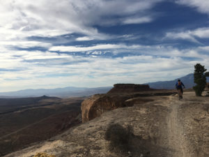
Gooseberry Mesa was my first ride on slickrock ride. The trailhead for the mesa is located just outside Hurricane UT about 2hr 45min from Las Vegas and 4hrs 45 min from Salt Lake City.  On the Mountain Bike Project website they say: “Gooseberry Mesa is a world class trail. It’s one of the best technical trails anywhere with rolling slickrock, twisty singletrack, and vistas to die for.” With that kind of description we had to go there and do some riding.

My trip started with a flight to Salt Lake City for an American Mountain Guide Association meeting. There I met with Rob Coppolillo and after the meeting we drove to the trailhead. We started the ride just after 3pm, pretty late for October 30th. So Rob and I started by doing the South Rim Trail then Hidden Canyon finally the Secret Trail back to the car. The ride we did was 17.5 miles long which took us 3hrs and 45 min to complete. We finished the last 20 minutes by headlamp.

The riding was cross country style and although there isn’t any real up or down the trails go over rough rolling terrain so there are short technical ups and downs throughout the ride. Instead of trying to describe the riding here are a few videos to give you a taste.

As per usual here is the geopdf map, gpx, and kml file so you can have the navigation info for the area. The map is is from utahmountainbiking.com and I geo referenced it onto Caltopo so you can import it into Avenza and have it sync with your phones gps and you’ll get a blue dot at your location.

Gooseberry Map 

Gooseberry Map KMZ

Gooseberry GPX of our ride
(Some browsers add a .xml extension, delete the .xml leaving only the .gpx extension before saving)
Gooseberry KML of our ride


Posted by Marc Chauvin in Maps, Mountain Biking

Ben Macdui via Faicaill Ridge Scramble with a Descent into Lairig Ghru

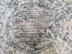
During my vacation to Scotland with my wife Jane, I took a day to do a little solo mission.  We had been hiking and climbing a lot and the weather was marginal with wind in the forecast.  Jane decided to take the train to Inverness while I went on a hike with a short scramble in the Cairngorm. I wanted to do the Faicaill scramble and summit Scotland’s 2nd highest summit, Ben Macdui.  The night before a friend had commented on Facebook that we should try to get into a picturesque valley to the west of Ben Macdui called Lairig Ghru.  The problem was there was no trail down from Ben Macdui to the valley. After a little research and a short discussion with someone at Glenmore Lodge it seemed going “cross country” down was reasonable. Below is a video of my route I made on Google Earth with a .kmz map overlay of the area. At the end of this post there is the .gpx .kmz and .kml files and a geopdf of the route.


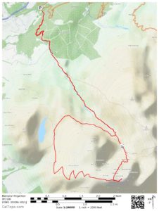
Here is a profile of the route
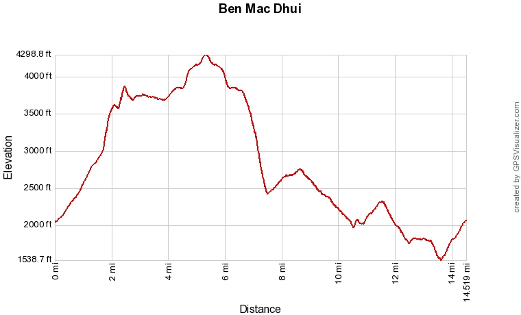
The route starts at the ski area and heads toward the Coire an t-Sneachda, a ravine on the side of Cairn Gorm. From partway into the coire I headed up toward the ridge. Again, some info I got at the Glenmore Lodge helped here as they told me about a short scramble getting up to the ridge that made gaining it more fun, it is a variation to the Faicaill called the Twin Ribs. From there I hit the main scramble, below is a picture of the Faicaill.
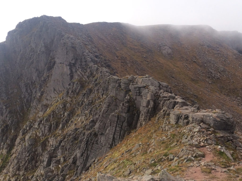
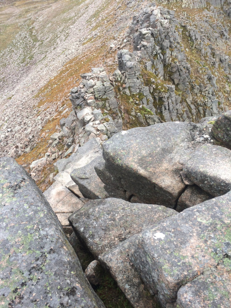
The scramble was short and pretty easy, I’d rate it mostly 3rd class with a short section of 4th class. Below is a picture looking down the crux.
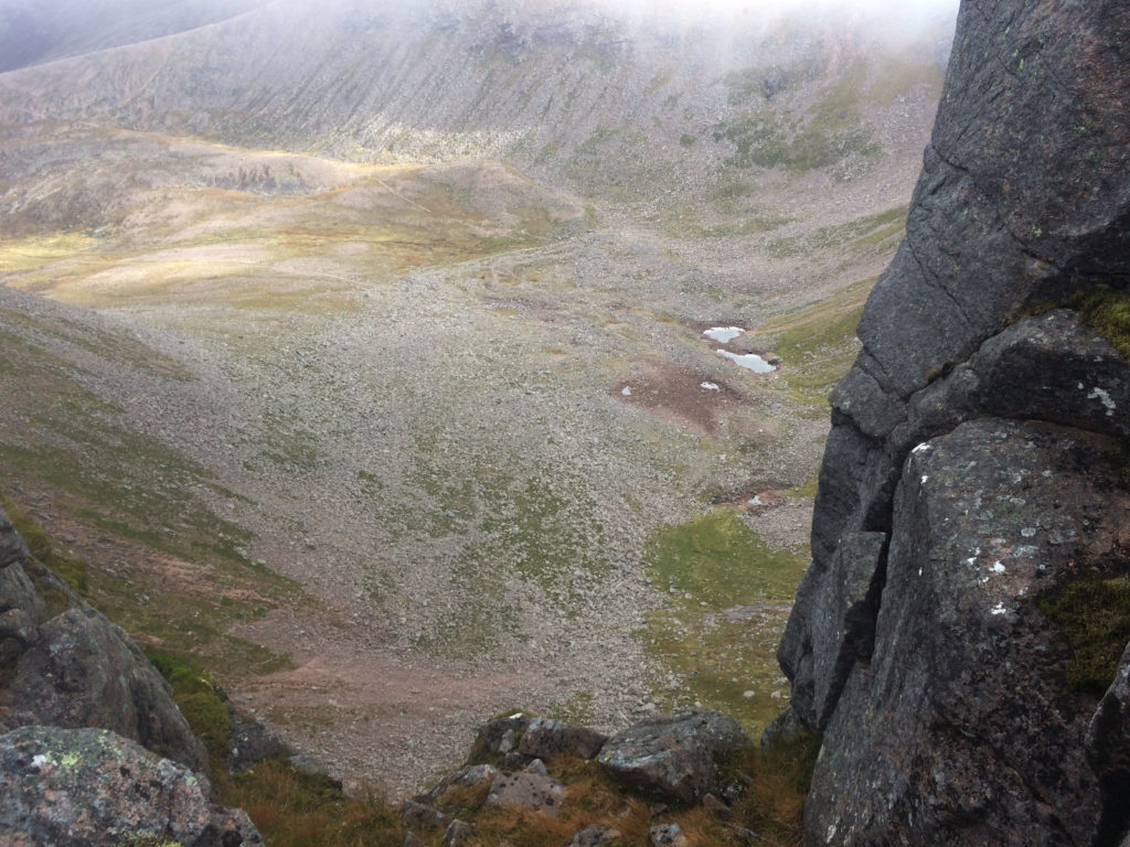
Looking from the ridge into the Coire an t-Sneachda.
Once at the top of the scramble the trail to Ben Macdui is pretty straightforward. Having said that it is on a very nondescript plateau feature which was in the fog as I walked it.  The trails are pretty well worn but there are no trail signs that I saw.  On my way I saw two groups going the other way both of which asked me to confirm that they were headed toward the ski area.  Having made a map that was geo-referenced on my phone gave me the confidence and simplified my navigation allowing me to move quickly through the terrain.  In no time I found myself at the top of Ben Macdui.
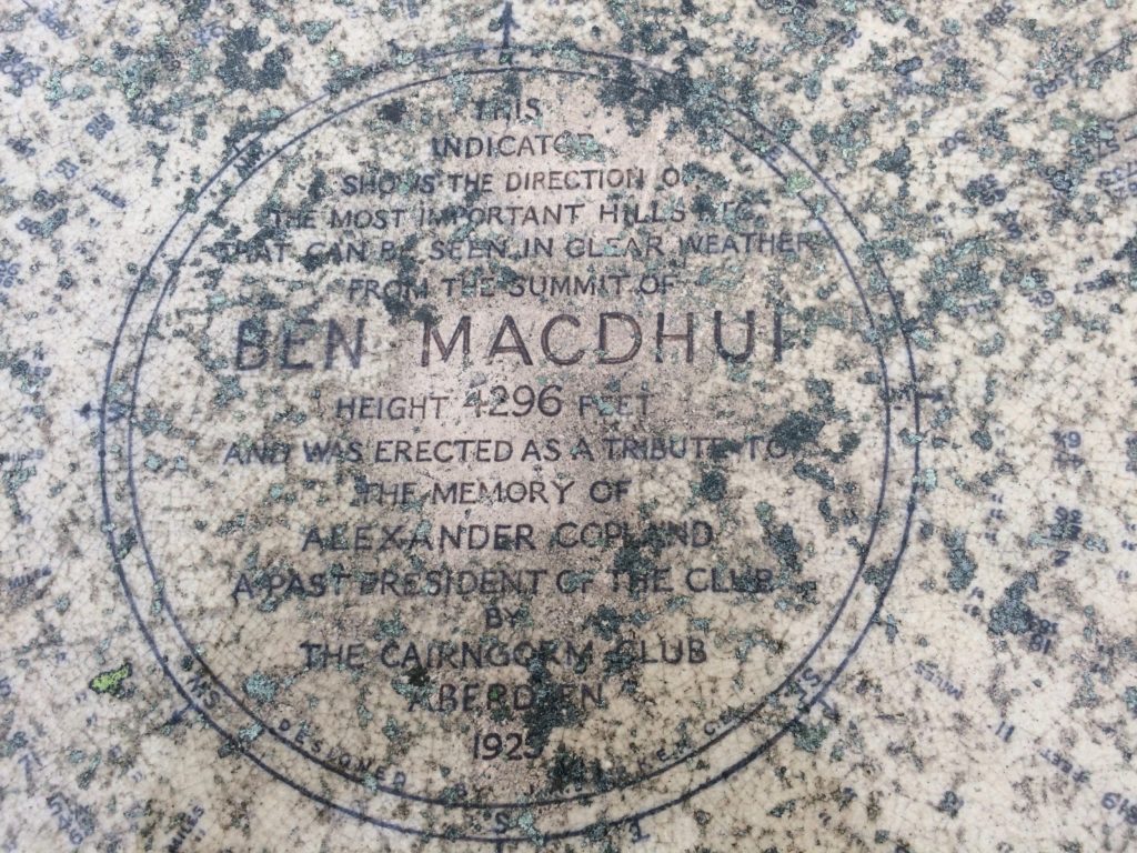
From the top of Ben Macdui I backtracked a little over a mile to where the track splits.  This junction was very hard to see if you weren’t paying attention and knew from the map that the trail spilt. I had heard that the Cairngorm can be a navigation challenge particularly in winter when the trails would be invisible and the fog created a true whiteout. Even in the summer it shouldn’t be taken lightly in a fog. At the split I started to head on my cross country section and in a few minutes I dropped below the fog and got a view of Lairig Ghru. Below is a picture looking south as I descended out of the clouds.

The cross country descent was reasonable consisting of a steep grass and heather slope. The going was slow as I picked my way down and my knees felt the descent but otherwise it was uneventful.  The views of the valley were spectacular and although I saw a party in the valley as I descended they were gone once I got to the bottom, I had the Lairig Ghru to myself.  At the base of the valley was a good trail but I was still more than 7 miles away from the car.

From the valley the walking is pleasant with not too many ups or downs. You climb a bit getting out of the valley then make your way to the Chalamain Gap. After the gap the trail gets much better as it makes its way back to the carpark.  Below is a picture looking back toward Chalamain Gap about a mile from the car.
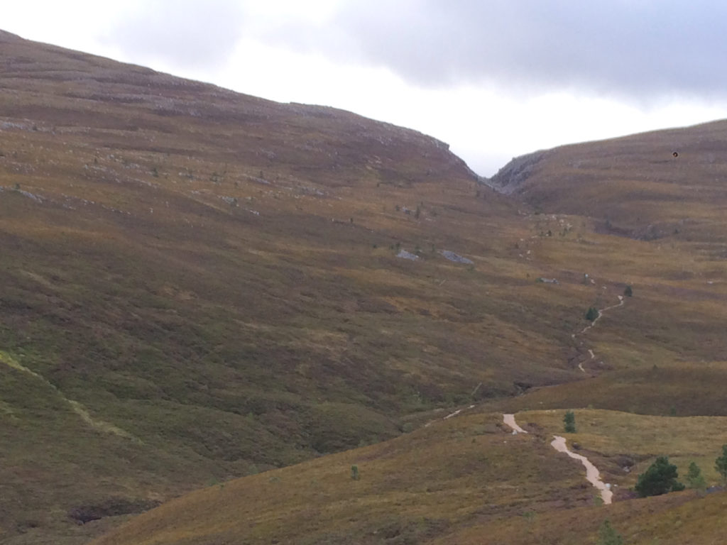
As promised here is the navigation data for the trip.
.KMZ File
.KML File
Ben-Macdui GPX (Some browsers add a .xml extension, delete the .xml leaving only the .gpx extension before saving)


Click picture for geopdf

Posted by Marc Chauvin in Climbing and Avalanche Education, Maps

Ben Nevis via Tower Ridge

My wife Jane and I went to Scotland for a vacation and we had the luck of having two really good weather days in Fort William. We used that luck to climb the classic Tower Ridge on the North side of Ben Nevis. This is a classic hard scramble/climb.  The ridge straddles the line between a scramble and a climb, I would rate it about 5.2/5.3 and alpine grade II. For those familiar with Cascade Routes it’s harder than the chimney section of the Fisher Chimneys but easier than the West Ridge of Forbidden. I carried a light rack of 3 Tri Cams (.5-2), 6 nuts, a few slings, a cordellette, and a few locking carabiners.  I took a 40m rope but a 20m/30m would have been fine but might have made retreat difficult. In the end I used only 3 placements as I was able to use horns the whole way and although I might still bring a light rack if I were to guide it the horns on the route could be used exclusively with a good eye for the terrain.

Here is a video I took of the ridge from the summit.

Of course I also have all the navigation data that you can download. Here is another video of a map overlaid on Google Earth using the .kmz file that you can download below.


Now for the navigation files:

Click for the data you want
.GEOPDF

.KML File

Tower Ridge GPX
(Some browsers add a .xml extension, delete the .xml leaving only the .gpx extension before saving)

.KMZ File

Jane halfway up the Tower Ridge on Ben Nevis

Posted by Marc Chauvin in Climbing and Avalanche Education, Maps

Cliff Area MBT Trails

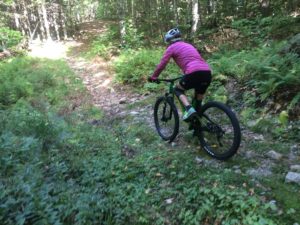
Cathedral and Whitehorse are both known for rock climbing but they are also a centerpiece of the mountain bike trails in that area.  Good cross country, nice downhills, technical uphills and great views make this area a fun and interesting place to ride.  You’ll notice a high density of trails around Echo Lake.  As far as I know all the trails are open to mountain biking but some have been particularly built for biking while others are old dirt roads and hiking trails.  The maze of trails there were difficult to map and take an inventory of.  Because of the density expect to be a little confused at times, some are so close together the gps may not be able to distinguish which one you are on.  They are as accurate as I could make them.

Again the White Mountain chapter of NEMBA has done a lot of work here so please support them any way you can.  You will notice on the southern end of the map one old dirt road (snowmobile trail) and a single track that head into the Marshall Property.  You can find a Marshall Property map here .

I hope you enjoy the map and the riding. The map is a Geopdf and will interface with the GPS in your phone if you use the Avenza App.
Click the photo below for the Cliff Area Map

Click to download the map

Posted by Marc Chauvin in Mountain Biking

Marshall Property Trails

The Marshall Conservation Area is Town Conservation Land that has been recently acquired. White Mountain Chapter of NEMBA has been quite busy building trails and upgrading and relocating older trails. Please assist them in any way you can WMMBA. My understanding is that there will be more work done over the next few years so the map below may start omitting trails or be in error.  The trails on this map were as accurate as I could make them as of late Fall 2016.  I will try to keep up with changes and update as often as possible.

The parking for the Marshall Property is 2.2 miles from the lights in Conway right where West Side Road crosses the railroad tracks. The Marshall Property’s Trails link nicely with the cliff area via the Mineral Mine Trailhead (shown on map) and the High School Loop Trail (not shown on map)  This means that for the most part you can ride single track trails from the Marshall Property to the Upper Stoney Trail that leads to the summit of Whitehorse.  With a bit more dirt road riding and double track (snowmobile trail) you can get roughly to the halfway point of the Cathedral Road giving access to the top of Cathedral. The map is a Geopdf and will interface with the GPS in your phone if you use the Avenza App. Click the photo below for the Marshall Property Map

Click to Download Map


Posted by Marc Chauvin in Mountain Biking

Thompson Road, Walmart and Outer Limits Area MTB Trails

Over the past few years I have started to mountain bike.  That new sport got me onto trails I never knew existed that were right in my backyard so to speak.  As I rode I would track myself so I could better make sense of the maze of trails I was riding. Those tracks would get imported into Caltopo and I started getting a good quality map of areas.  The Mount Washington Valley has numerous areas but can be broken up as East Side and West Side.  Those two sides can be further broken up into two sections each splitting the valley into quarters.  The West Side has the Marshal Property to the south and the cliff area to the north.  The East Side can be broken up by Black Cap area to the north and the Thompson/Walmart/Outer-limits area to the south.  This last area is the most dense area of trail and would make North Conway a special area for biking if it were the only place to bike.  For that reason it is the focus of this map.

Numerous maps exist but trails get relocated or new ones get built. As far as I have found this map is the most accurate and complete but expect some adventure.  NoCo biking is; low key, loosely organized and not overbuilt. In short it’s a great low key place to ride and people want to keep it that way.

Most if not all of the trails are built by the White Mountain Chapter of NEMBA and East Side Bike Guides and are free to use, please support them any way you can. You can also find more maps here   The trails on the map below cross; town, state and private conservation land.  Please be respectful of closures and trails that are hiking only.  Mountain biking is well accepted and the areas that are closed are few and for good reason.

The map is a Geopdf and will interface with the GPS in your phone if you use the Avenza App.
Click the photo below for the Thompson Rd, Walmart, Outerlimits Map

Click to Download the Map


Posted by Marc Chauvin in Mountain Biking