
During my vacation to Scotland with my wife Jane, I took a day to do a little solo mission. We had been hiking and climbing a lot  and the weather was marginal with wind in the forecast. Jane decided to take the train to Inverness while I went on a hike with a short scramble in the Cairngorm. I wanted to do the Faicaill scramble and summit Scotland’s 2nd highest summit, Ben Macdui. The night before a friend had commented on Facebook that we should try to get into a picturesque valley to the west of Ben Macdui called Lairig Ghru. The problem was there was no trail down from Ben Macdui to the valley. After a little research and a short discussion with someone at Glenmore Lodge it seemed going “cross country” down was reasonable. Below is a video of my route I made on Google Earth with a .kmz map overlay of the area. At the end of this post there is the .gpx .kmz and .kml files and a geopdf of the route.
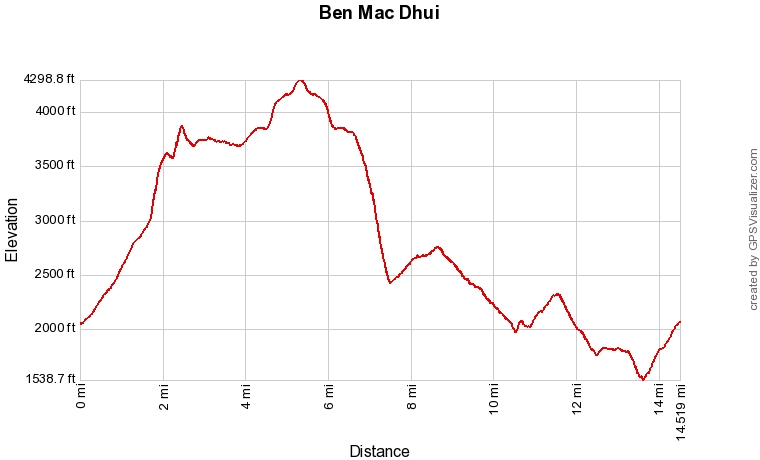
Here is a profile of the route
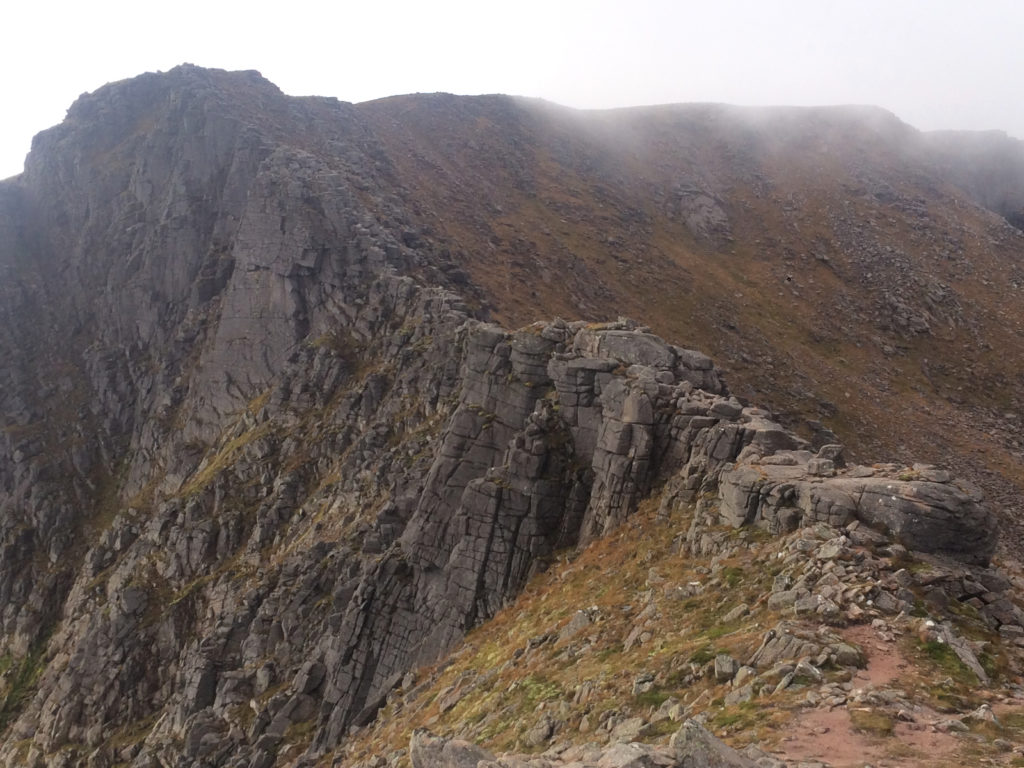
The route starts at the ski area and heads toward the Coire an t-Sneachda, a ravine on the side of Cairn Gorm. From partway into the coire I headed up toward the ridge. Again, some info I got at the Glenmore Lodge helped here as they told me about a short scramble getting up to the ridge that made gaining it more fun, it is a variation to the Faicaill called the Twin Ribs. From there I hit the main scramble, below is a picture of the Faicaill.
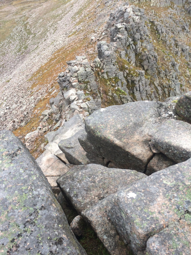
The scramble was short and pretty easy, I’d rate it mostly 3rd class with a short section of 4th class. Below is a picture looking down the crux.
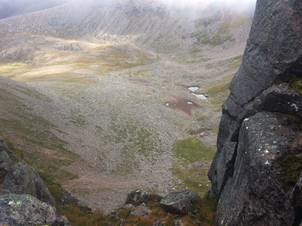
Looking from the ridge into the Coire an t-Sneachda.
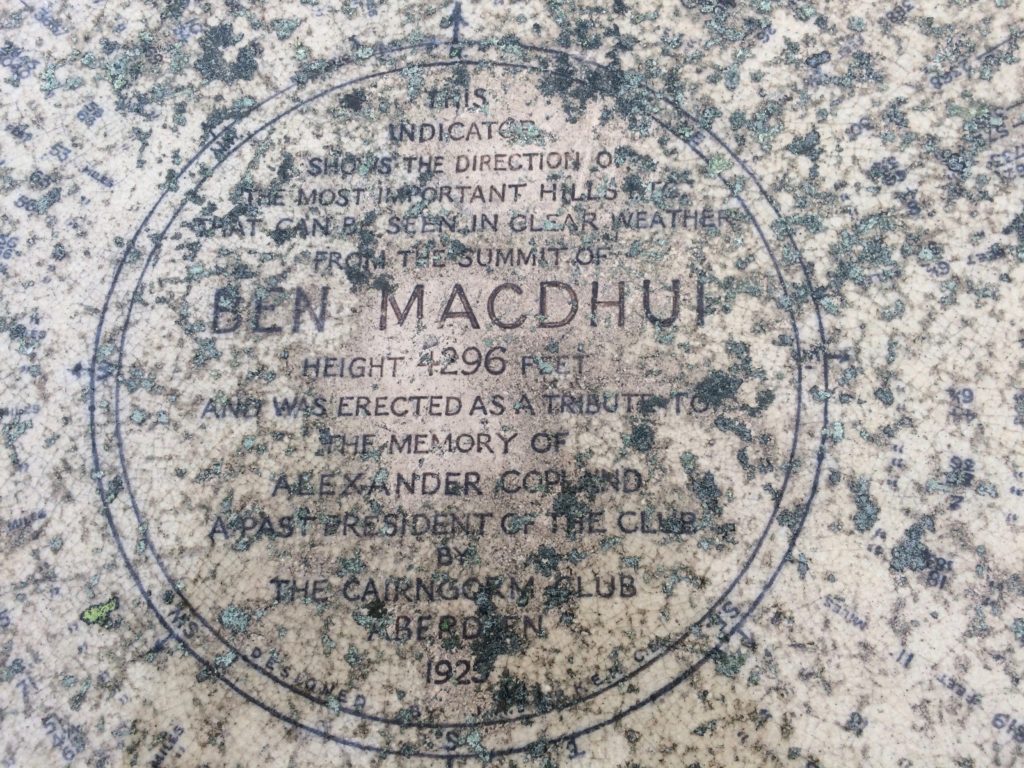
Once at the top of the scramble the trail to Ben Macdui is pretty straightforward. Having said that it is on a very nondescript plateau feature which was in the fog as I walked it. The trails are pretty well worn but there are no trail signs that I saw. On my way I saw two groups going the other way both of which asked me to confirm that they were headed toward the ski area. Having made a map that was geo-referenced on my phone gave me the confidence and simplified my navigation allowing me to move quickly through the terrain. In no time I found myself at the top of Ben Macdui.
From the top of Ben Macdui I backtracked a little over a mile to where the track splits. This junction was very hard to see if you weren’t paying attention and knew from the map that the trail spilt. I had heard that the Cairngorm can be a navigation challenge particularly in winter when the trails would be invisible and the fog created a true whiteout. Even in the summer it shouldn’t be taken lightly in a fog. At the split I started to head on my cross country section and in a few minutes I dropped below the fog and got a view of Lairig Ghru. Below is a picture looking south as I descended out of the clouds.

The cross country descent was reasonable consisting of a steep grass and heather slope. The going was slow as I picked my way down and my knees felt the descent but otherwise it was uneventful. The views of the valley were spectacular and although I saw a party in the valley as I descended they were gone once I got to the bottom, I had the Lairig Ghru to myself. At the base of the valley was a good trail but I was still more than 7 miles away from the car.
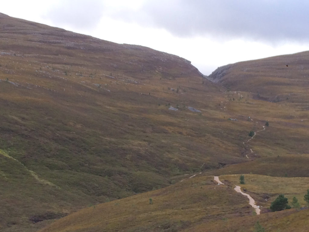
From the valley the walking is pleasant with not too many ups or downs. You climb a bit getting out of the valley then make your way to the Chalamain Gap. After the gap the trail gets much better as it makes its way back to the carpark. Below is a picture looking back toward Chalamain Gap about a mile from the car.
As promised here is the navigation data for the trip.
 .KMZ File
.KML File
Ben-Macdui GPX (Some browsers add a .xml extension, delete the .xml leaving only the .gpx extension before saving)