Month: May 2017

Cliff Area MBT Trails

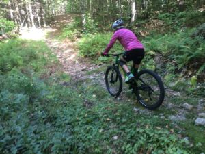
Cathedral and Whitehorse are both known for rock climbing but they are also a centerpiece of the mountain bike trails in that area.  Good cross country, nice downhills, technical uphills and great views make this area a fun and interesting place to ride.  You’ll notice a high density of trails around Echo Lake.  As far as I know all the trails are open to mountain biking but some have been particularly built for biking while others are old dirt roads and hiking trails.  The maze of trails there were difficult to map and take an inventory of.  Because of the density expect to be a little confused at times, some are so close together the gps may not be able to distinguish which one you are on.  They are as accurate as I could make them.

Again the White Mountain chapter of NEMBA has done a lot of work here so please support them any way you can.  You will notice on the southern end of the map one old dirt road (snowmobile trail) and a single track that head into the Marshall Property.  You can find a Marshall Property map here .

I hope you enjoy the map and the riding. The map is a Geopdf and will interface with the GPS in your phone if you use the Avenza App.
Click the photo below for the Cliff Area Map

Click to download the map

Posted by Marc Chauvin in Mountain Biking

Marshall Property Trails

The Marshall Conservation Area is Town Conservation Land that has been recently acquired. White Mountain Chapter of NEMBA has been quite busy building trails and upgrading and relocating older trails. Please assist them in any way you can WMMBA. My understanding is that there will be more work done over the next few years so the map below may start omitting trails or be in error.  The trails on this map were as accurate as I could make them as of late Fall 2016.  I will try to keep up with changes and update as often as possible.

The parking for the Marshall Property is 2.2 miles from the lights in Conway right where West Side Road crosses the railroad tracks. The Marshall Property’s Trails link nicely with the cliff area via the Mineral Mine Trailhead (shown on map) and the High School Loop Trail (not shown on map)  This means that for the most part you can ride single track trails from the Marshall Property to the Upper Stoney Trail that leads to the summit of Whitehorse.  With a bit more dirt road riding and double track (snowmobile trail) you can get roughly to the halfway point of the Cathedral Road giving access to the top of Cathedral. The map is a Geopdf and will interface with the GPS in your phone if you use the Avenza App. Click the photo below for the Marshall Property Map

Click to Download Map


Posted by Marc Chauvin in Mountain Biking

Thompson Road, Walmart and Outer Limits Area MTB Trails

Over the past few years I have started to mountain bike.  That new sport got me onto trails I never knew existed that were right in my backyard so to speak.  As I rode I would track myself so I could better make sense of the maze of trails I was riding. Those tracks would get imported into Caltopo and I started getting a good quality map of areas.  The Mount Washington Valley has numerous areas but can be broken up as East Side and West Side.  Those two sides can be further broken up into two sections each splitting the valley into quarters.  The West Side has the Marshal Property to the south and the cliff area to the north.  The East Side can be broken up by Black Cap area to the north and the Thompson/Walmart/Outer-limits area to the south.  This last area is the most dense area of trail and would make North Conway a special area for biking if it were the only place to bike.  For that reason it is the focus of this map.

Numerous maps exist but trails get relocated or new ones get built. As far as I have found this map is the most accurate and complete but expect some adventure.  NoCo biking is; low key, loosely organized and not overbuilt. In short it’s a great low key place to ride and people want to keep it that way.

Most if not all of the trails are built by the White Mountain Chapter of NEMBA and East Side Bike Guides and are free to use, please support them any way you can. You can also find more maps here   The trails on the map below cross; town, state and private conservation land.  Please be respectful of closures and trails that are hiking only.  Mountain biking is well accepted and the areas that are closed are few and for good reason.

The map is a Geopdf and will interface with the GPS in your phone if you use the Avenza App.
Click the photo below for the Thompson Rd, Walmart, Outerlimits Map

Click to Download the Map


Posted by Marc Chauvin in Mountain Biking