Imagine a person who had never seen anyone ski but had heard that skiing downhill was not only more efficient than walking, it 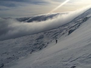 was fun too. That person then got himself a pair of skis and went to the top of a ski area and tried skiing, again without any experience seeing someone ski. After many falls and struggles and likely long before reaching the bottom our imaginary person would be pretty convinced that skiing was not only inefficient but painful and no fun at all.
That story is an exaggeration of what I have seen about using skis to climb or as most call it skinning. Few people have had the benefit of seeing someone good at skiing uphill and there is a feedback loop that has happened that creates a false consensus that skinning is for nothing more than low angled trails in the woods. If you ever get to see large groups of people who are competent at skinning you would quickly realize steeper skinning isn’t inefficient you just have never seen it’s efficiency and haven’t worked at developing the technique.
Wow! I’m sure at this point some are offended but trust me that isn’t my goal. I really do not worry about people who would rather boot their way up a gully or run or belittle their opinion that they would rather boot. But if you want to take your backcountry skiing/ski mountaineering to the next level then understanding the importance of developing good uphill technique is likely your next step.
Let me continue with another story. When I first started skinning up to Tuckerman Ravine I was one of only a handful that skinned or used AT gear and heard over and over again how bad an idea it was. Now, on any given day I see nearly no one carrying his or her skis up to Hermit Lake. My experience in France seeing skiers skin allowed me back then to ignore what those in this area said but because, in the big scheme of things, I was only a beginner at skinning I wasn’t the best ambassador. Over time however people have seen more and more skinning and now it’s common on the trails.
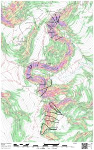
The next step is taking that skill and increasing the steepness of the terrain you can skin and incorporating ski crampons. Given the type of snowpack and terrain we have here, ski crampons should be in the quiver of most of the people that ski in this area, yet they are rare. I have seen a few more people with ski crampons and using solid uphill kick turns and I am sure this will catch on. So if skiing in the mountains is your goal and you can turn’em going downhill, I would suggest working on these uphill skills:
1) Quick transitions of all types
- Uphill to down hill
- Putting your ski crampons in and out of your bindings
- Skinning to booting
- Booting to skinning
- Downhill to uphill
2) Master the uphill kick turn
3) Incorporate ski crampons into your skinning
4) Learn to read terrain for the ascent
5) Learn the power of your lifters and their downside
6) Remember that you spend a lot of time climbing and take that into consideration when you choose your equipment. Skiing the heavy gear may seem to make sense to a skier used to lifts but buying the heavy stuff reduces your uphill ability. Think carefully about that weight to stiffness balance. Remember you may very well be a much better downhill skier than an uphill one so skiing down with lighter gear may be easier than pushing heavy gear up the hill.