
There are a lot of ways to look at the avalanche problem. There is a risk to oversimplification but equally there is a risk to 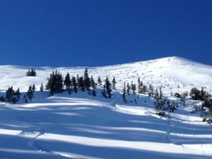 complicating the hazard. With that in mind how can someone that has limited experience or limited knowledge start the process of making a decision? Hopefully the bullet points below can help you.
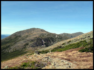
- Know when you are in avalanche terrain. Know the angle of the terrain you are on or are about to go on and learn the common angle for avalanches in your area. As a standard the bullseye is between 33 and 43 degrees. So measure, measure, measure both with maps or in the field till you develop a good estimation ability. Remember an icy 40 degree slope can seem very steep and a 40 degree slope with softer snow may not seem very steep at all.
- Know the danger rating and believe it. Considerable and above is serious risk. High and extreme should be avoided completely to the point it’s worth buying a ticket at the ski area.
- Know the avalanche problem and how that affects your ability to see the problem. If it is New Snow there may be a variable based on elevation due to precipitation rate but where there is enough snow (10 inches new snow or more) the problem is widespread. If the problem is Wind Slab learn to recognize where the wind has blown the snow based on the “look” of the snow and the direction the slope faces. If the problem is a Wet Slab, well then if it is warm you have a problem. If the problem is Cornice Fall, stay away from slopes with cornices. Persistent or Deep Slab problems are hard to manage so be conservative, again when there is a Persistent or Deep Slab problem stay on terrain less than 33 degrees and even below 30 degrees if the avalanche forecast is Considerable. With the Persistent and Deep Slab you need to consider connected slopes and terrain above as well since those hazards are more prone to remote triggering. If those problems are widespread or very reactive go to the ski area, generally in those conditions the danger rating will be high or extreme.
- Watch the weather to see if it is stressing the the snow. Is it getting warmer than the forecast expected, is the slope cooling rapidly, is the slope getting loaded by a local wind event not in the forecast or by a snow squall or snow shower not predicted. Is something happening with the weather that the danger forecast and weather forecast did not expect.
- Is the avalanche survivable? Look at the slope, if it were icy and you fell down it could you survive? If not is there an alternative line? This may seem extreme but if the slope slides you will fall down it. Hitting rocks or trees or getting flushed over a cliff isn’t softer because you are surrounded by moving snow. Harder to perceive, is if the bottom of the slope will collect snow such that you will be buried too deep to rescue, if you are buried by 6 feet or more of snow you’re likely going to be a fatality.
- Go one at a time through avalanche terrain and plan for a rescue. Have the gear and have a strategy that will only bury one person and the others are in an effective place to get to the victim and uncover them in 15 minutes or less.
Notice there is very little snow science. Snow is hard to know and your ability to collect data and evaluate it is limited particularly if you aren’t out every day or have limited experience. I really hope these strategies help you.
 Here is a video of a Caltopo Digital Elevation Model map of Mount Washington overlaid on Google Earth. The key on the left denotes what color relates to which angle. This is one of the skills you’ll learn during a Chauvin Guides International Navigation Course.


 Over the last few years I have been adjusting my work over the spring, summer and fall from rock climbing in NH to traveling more and trying to guide more alpine terrain. This year was the culmination of that change with what amounted to a 5 month road trip with a focus on alpine climbing in the Alps and in the North Cascades. The only thing I could add next year to make it even more alpine would be an Alaskan trip in spring. No plans for that but one never knows what opportunities might come around.


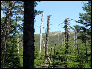
 Many have heard of the Pemi Loop here in the White Mountains and it has become the signature long trail run/speed hike in the White Mountains. The Pemi Loop is just over 30 miles and it has an elevation gain and loss of about 9100 feet The thing about the Pemi Loop is that it does not go over the signature range in the White Mountains, the Presidentials! The long hike/run in the Presidentials tends to be and end to end hike that requires two cars and the logistic of a car spot. What I wanted was a loop hike like the Pemi Loop with the same kind of distance and elevation gain and included the majority of the Presidentials, what I came up with was the Presidential Figure of Eight. The reason I call it the Figure of Eight is because of the shape of the route when drawn on a map. The route starts at the AMC Pinkham Notch Camp and climbs via the Tuckerman Ravine Trail across the Bigelow Lawn to Lakes of the Clouds Hut. From there it continues down the Crawford Path and Webster Cliff Trail to Mizpah Hut. From Mizpah the “eight” goes down the Mount Clinton and Dry River Cut-Off trails to the Dry River trail and follows that up the Dry River and Oakes Gulf back up to the Lakes of the Clouds Hut. From there it goes up the Crawford Path towards Mount Washington to the Westside Trail and onto the Gulfside Trail. The Gulside trail is then followed all the way to Mount Madison then down the Osgood and Osgood Cut-Off to the Madison Gulf Trail then on to the Old Jackson Road back to Pinkham. The Presidential Figure of Eight Loop is 30.6 miles long with an elevation change of 10,000 feet. Here is a PDF Map of the route with hour splits, the red line sections are the sections I was able to run while the blue line sections are where I did some speed hiking, it is best viewed at 150%.


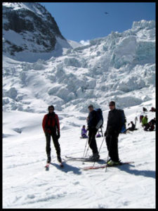 Whenever I haven’t written in my blog for awhile I find it difficult to get started writing one. Often it is not because I don’t have anything to write about it’s usually because too much has gone on and I feel daunted trying to write it all down. For instance my last entry was posted in the middle of March. Since then I’ve ice climbed with Hakan and Mike who were training for Rainier, I climbed with Ed and his grandson for two days, I I taught two 4 day AIARE Level II Avalanches Courses, got to climb with Harold who has been coming up to climb at the end of March for as long as I can remember and I got to climb with Jacky and Tim. That list ended my March. At the start of April I left for Chamonix to do some ski tours, I had scheduled two Chamonix-Zermatt Haute Routes, the first with Ryan, Mike and David the second Haute Route was with Joe, Cameron and Tom.


 Chirouze Right: This run starts from the top of the lifts and requires some walking. It begins on a glacier, a beautiful powder run but ends up in a steep narrow and icy gully that requires a rappel. Because of it’s complex finish it holds fresh tracks long after a storm.


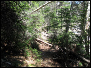
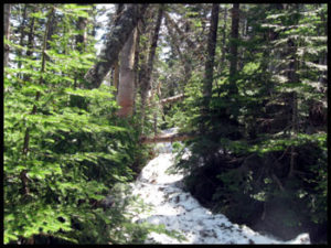
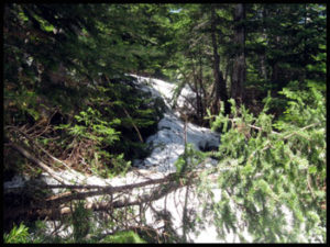
 Yesterday I went for a trail run/hike. I had a few days off and and this week seemed like a good time to do something I have been wanting to do for awhile. I have day hiked pretty long distances above treeline in the winter before but I have always done it in spectacular weather. I had always wondered if light weight fast hiking was possible in real winter weather. What I wanted to do was a winter Presidential Traverse but spotting cars etc. was not possible seeing I would be alone. What I came up with was a loop traversing over the Northern Presidentials including Mount Washington from the AMC Pinkham Notch Camp. I would start on the Old Jackson Road to Madison Gulf Trail across the Osgood Cutoff to the Osgood Trail then across the Gulfside Trail then down from Mount Washington via the Lion’s Head Trail.


