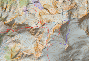
Next in the series of North Cascades maps is Shuksan. This complex mountain has a wide variety of routes from the  straightforward Sulfide Glacier route to the classic mixed alpine route of the Fisher Chimneys and the steeper and remote North Face. The summit pyramid requires some rock scrambling up the South Gully but also has more difficult ridges on its Northeast side and beside the South Gully to the East (SE Ridge).
Shuksan also has a route that some of the AMGA groups have done from the White Salmon Glacier I am calling the Southwest Buttress although that may be an incorrect name. I have not found any info on the route online. I was involved in a course that did the route but I have not done it myself so the line may be off. I have also included the Sulfide Glacier Route as well and have not done that one either. All the other routes I have done numerous times.
You’ll note that there are two blue shaded sections near the base of the White Salmon Glacier. These sections have an overhead hazard from seracs. The larger one is quite serious since the seracs come from the Hanging Glacier high above. The smaller zone comes from a small barrier on the White Salmon itself.
I guess I should give you a warning, the routes below might have errors and does not replace good route finding skills. Use at your own risk.
Here is the Geopdf map
Shuksan
Here is the .KMZ file
Shuksan.kmz
Here is the .kml and .gpx files of the routes
Shuksan.kml
Shuksan GPX (Some browsers add a .xml extension, delete the .xml leaving only the .gpx extension before saving)
